Saint Michael line : history of the spirit and alignments between heaven and earth with a magical vision in time and space.
After the last frames of Star Wars episode 7, even the esoteric alignment that for hundreds of years had been attracting more or less restricted circles of “adepts”, has been revealed to the general public, or, at least, the starting point of the line, namely the evocative profile of the island of Skelling Michael, off the coast of Ireland.
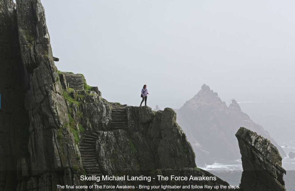
The year of the first settlement on Skelling by Protocristian monks is 588 D.C. Shortly before, there had been places of Michael worship at Saint Michael’s Mount in Cornwall (495 D.C.), at Monte Sant’Angelo in Puglia (490 D.C.) and in the island of Symi in Greece (450 D.C.).
Saint Michael line is completed by two other places of worship that arose in later times: the first at Mont Saint Michael in Normandy (706 AD) and the second on Mount Pirchiriano in Val di Susa with the beginning of the construction of the Sacra di San Michele (966 AD).
A separate mention deserves the seventh point that is the key to this alignment: the Armageddon mountain along the chain of Mount Carmel in Israel.
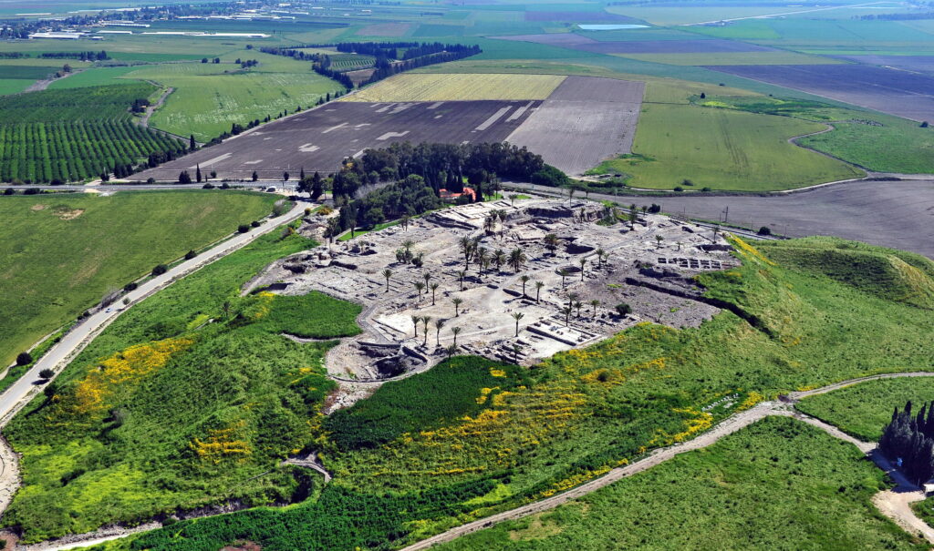
https://commons.wikimedia.org/w/index.php?curid=36308008
This is how the past and the future meet on this “synchronic” Saint Michael’s line: from the Neolithic settlements of Tell Megiddo to the Star Wars warriors there is a common thread that brings us back to Skelling where Celtic Irish monks had settled.
The Gaelic name of the island is Sceilig Mhichíl, while the rocks that dominate the landscape and constitute the building material of the very small monastic cells are sandstones originated during the Devonian (geological date datable around 390 M of years ago) with a typically red color.
From a geographical point of view, the site is 4200 km away from Megiddo and its azimuth is 134 ° according to a program of spherical trigonometry; as we will see, all the other points have their azimuth along the line with an approximation of 9°, so that the alignment is almost perfect. Another interesting aspect is that the main direction of opening of the ancient settlement is between 90 ° and 120 °N, between east and southeast, directed towards the rising sun but also towards Israel.
Now we come to the second point of saint Michael line: Saint Michael Mount which is on the island of Iktis in Cornwall (Karrek Loos y’n Koos in Cornish). Saint Michael’s cult is linked to a Benedictine abbey, which was then destroyed, born in times after the Michaelite settlement in Brittany to recall an apparition of the archangel dated 495. Survival of Michael’s cult is a church (photo on the top left) currently included in the 16th century fortress.
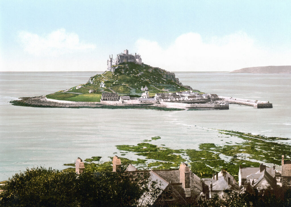
By Unknown author – This image is available from the United States Library of Congress’s Prints and Photographs division under the digital ID ppmsc.08234.This tag does not indicate the copyright status of the attached work. A normal copyright tag is still required. See Commons:Licensing., Public Domain,
“Photographs in this collection were published before 1929 and are therefore in the public domain.” from the Wikimedia Commons
From a geographical point of view, the site is 3850 km from Megiddo and even here the azimuthal orientation is similar to the others (132°), while the church is oriented exactly to the east. The geological period should correspond to the Devonian granite (410 M of years ago).
The third point crossing saint Michael line is one of the most famous, perhaps the most popular one: it is Mont Saint Michael in Normandy, a landscape icon of northern France.
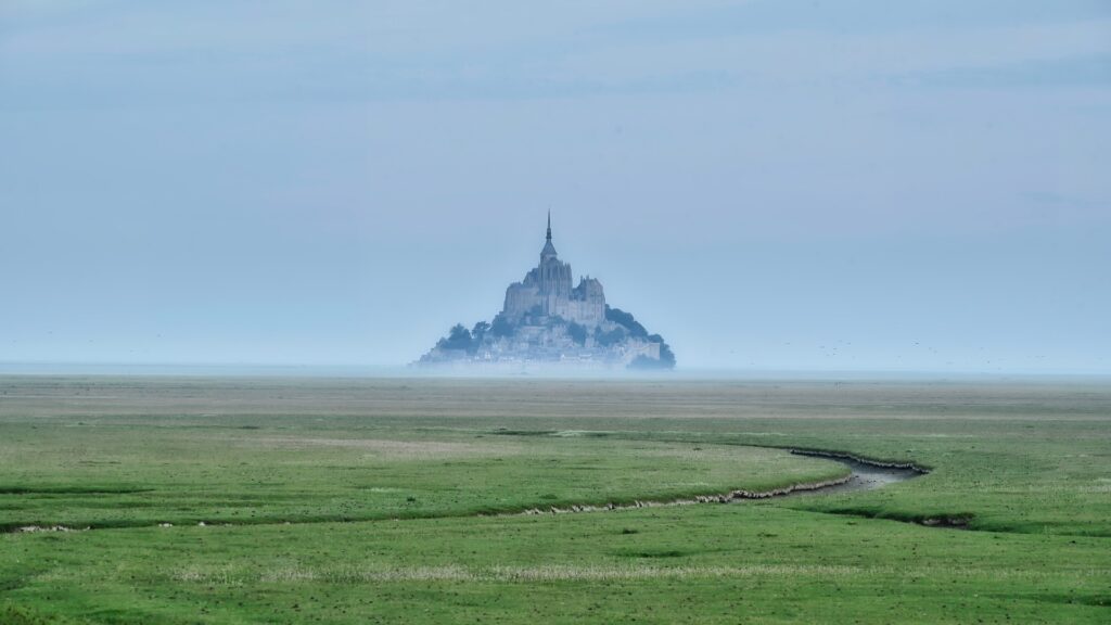
Actually, the original name of the mountain hides the cult that preceded the Michaelite one, which dates back to 700 AD. The site was sacred to Celtic rites and was considered the tomb of the god Beleno. In the same place the Black Madonna, the Queen of the Underground World, was then venerated. Here are the reasons why we can believe that this mountain, like many others, was considered one of the entrances to the underworld.
Mont Saint Michael, that in Breton is named Menez Mikael ar Mor, is 3520 km far from the Armageddon with an azimuth of 131°. The geological substratum of the island is constituted by Cambrian leucogranites (525 million years ago).
The church on the top of the mountain dedicated to St. Peter is oriented at about 260 ° N, to the west.
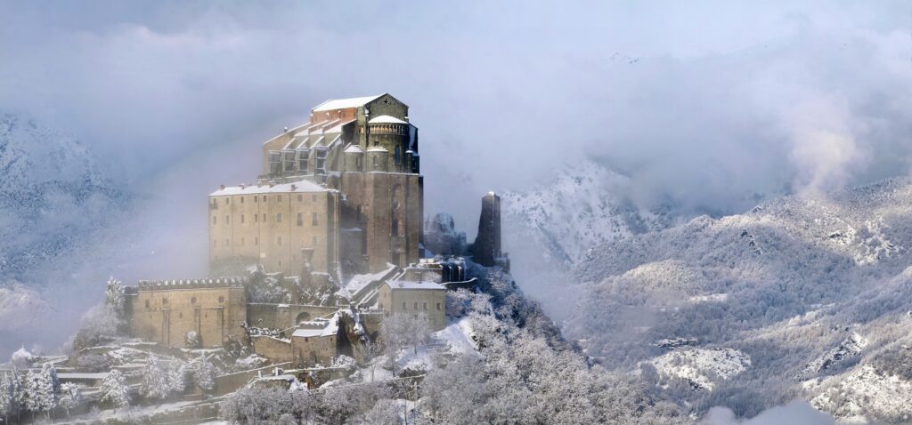
After passing three points in northern European areas, we enter Italy through the Val di Susa where, at its entrance, we find the Pirchiriano mount on which, around the year 1000, the “Sacra di San Michele” was built.The origin of the name of this mount is controversial: it could be Porcarianus (due to pigs that were grazing on it) or Pir-Kyrianos (Fire of the Lord, the globe of fire that appeared to the founder of the Sacra), but neither of these two interpretations is excluded, because it often happens that in this kind of places historical stratifications overlap linguistic ones and vice versa.
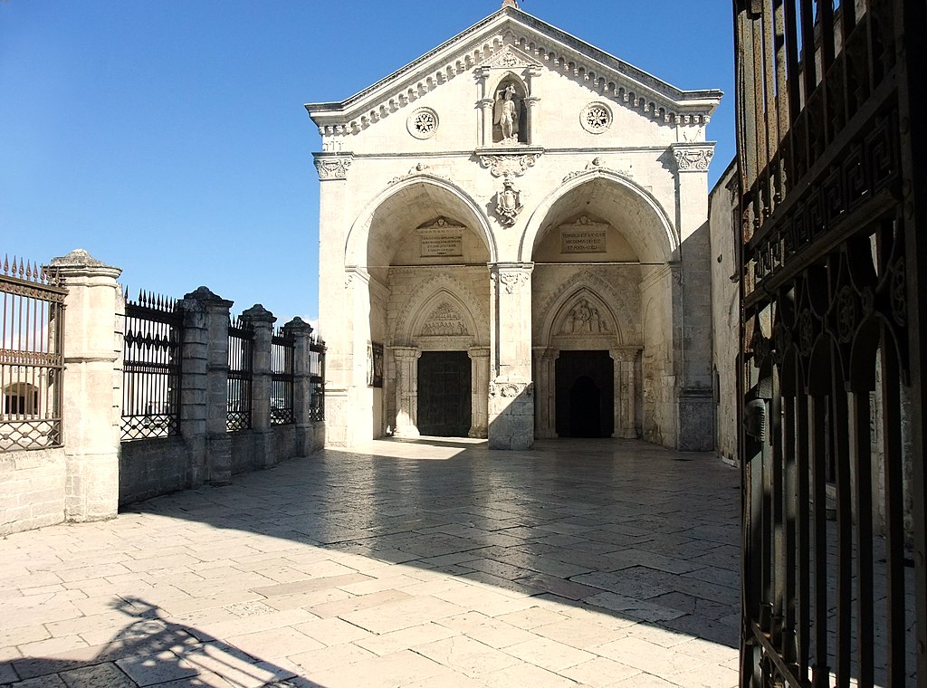
As for the position on the line, Monte Sant’Angelo has an azimuth of 126* with Megiddu; its distance from Armageddon is 1970 km, while the church is directed to the north. It is difficult to calculate the exposure of the cave.
Finally, the sixth point before Armageddon is the island of Symi, just north of Rhodes, with its orthodox monastery near Panormitis, located at sea level, with a geology presumably made up of recent calcareous marine sediments.
This is the closest point to Israel (800km), with an azimuth of 125° with Megiddu, and it’s characterized by a relatively recent construction (1100th D.C.) even if the era of Saint MIchael’s vision is reported to 450 D.C.

After this excursus on the seven sites, there is nothing left to say but ask oneself what could be the meaning of Saint Michael line, highlighted below which does not appear straight on the account of the curvature of the earth, Nevertheless, this has been taken into account by a program of spherical trigonometry, verified by ArcGIS, whose application allowed to report a table containing the angular distances of the six monasteries to two places: Megiddu and Mount Carmel. They are only few kilometers distant from each other so that there is not a significant difference in the choice between them to calculate their angular distance from the six monasteries. Consequently we can assume that the end of the lineshould be in any case located in Israel.
| Sites | Longitude | Latitude | azimuth to Megiddu | azimuth to Mount Carmel | |
| Mt. St. Michel | -1,54623 | 48,62449 | 131,28388 | 131,13103 | |
| Sacra di S. Michele | 7,34004 | 45,09637 | 128,34122 | 128,13917 | |
| S. Michele Arcangelo | 15,95482 | 41,70807 | 126,37788 | 126,09608 | |
| Mount Megiddo | 35,17555 | 32,58002 | |||
| Skelling Michael | -10,53861 | 51,77222 | 134,10124 | 133,97814 | |
| St. Michael’s Mount | -5,47750 | 50,11583 | 132,63635 | 132,49874 | |
| Greek Orthodox Monastery of Taxiarchis Mihail Panormitis | 27,84611 | 36,54833 | 125,36483 | 124,72260 | |
| Mount Carmel | 35,04839 | 32,74273 |
From these data, several hypotheses can be made, essentially of two types.
The first could be a connection between macrocosm and microcosm. This opens up a complex astronomical chapter in which many variables can be taken into consideration, starting from the 4 Royal Stars traditionally associated with the 4 archangels, up to the solstice and equinoctial points and to other important points such as the galactic center.
Once the variables have been chosen, it is a matter of verifying- on a temporal scan which is actually rather vast – how the celestial points are configured with respect to the alignment.
In the example above we see the Sun at sunset exactly aligned to the west of the main axis of the Sacra at the spring equinox of the year 999 while Aldebaran, the star corresponding to the archangel Michael and ruling the cardinal point of the east, is located 30° from the Sun in a semisextile angle.
The simplest astronomical interpretation is that the rising Sun at the winter solstice is at 125 ° of azimuth (at 45° of latitude), therefore precisely on this line: this space-time in Michael’s and Apollo’s sacred places would become even more important because the date of December 21 is associated with Christ’s birth, the solar symbol and healer par excellence. With the Sun entering Capricorn, the new seasonal cycle starts, and the return of Light is celebrated with the beginning of the New Year. All the seven points of the line at the solstice of December 21 are enlightened by the Sol Invictus.
Even without any astronomical correspondence, however, the line could be traced back to a terrestrial form with a celestial value, according to a typical Feng Shui parallelism. The forms that can be recognized are those of the sword and the cross, adding an arm as in the following drawing:
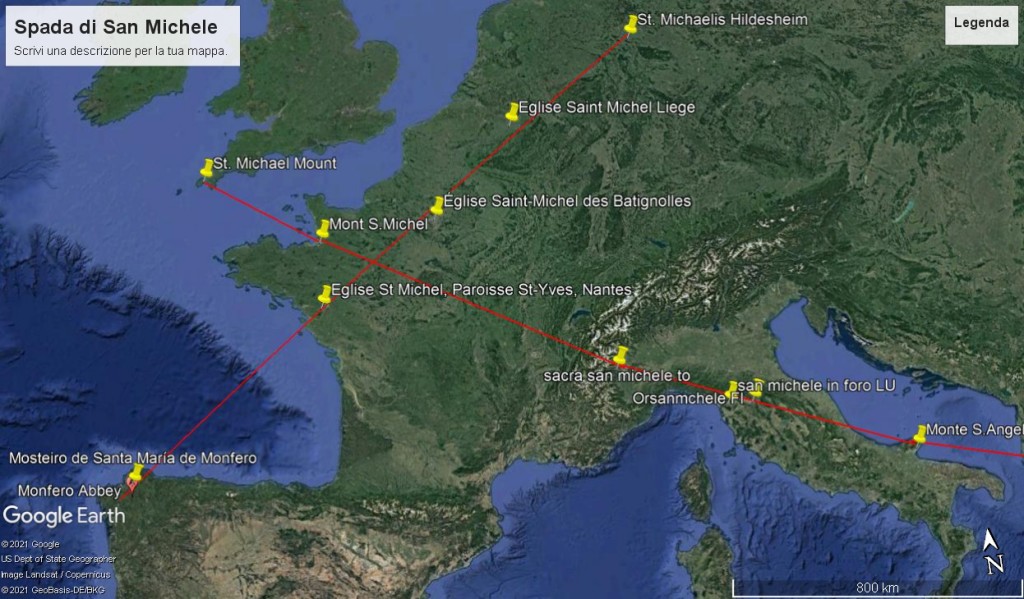
In this example, the second alignment consists of the following sites: Monastery of Santa Maria de Monfero in Galicia, Nantes in Brittany, Paris, Liège in Belgium and Hildesheim in Germany. These sacred sites include four churches dedicated to St. Michael and a Marian monastery. This line would form the short side of the Cross or the hilt of Michael’s sword.
There are actually many sacred centers dedicated to the archangel Michael and therefore there are many possible geometric combinations but, remaining on the rectilinear direction with the azimuth closed to the line of the solstices, seven points are added to the canonical ones: Lucca (church of San Michele in Foro) , Florence (Orsanmichele), Perugia (church of San Michele Arcangelo) and Rome (Castel Sant’Angelo), without forgetting two less important places from an artistic-architectural point of view such as the church of San Michele in Castiglione Garfagnana and the bridge of San Michele al Serchio in the province of Lucca.
Moreover, If we should add the pairs of synchronous lines as suggested for example by Sig Lonegren, a masculine one and a feminine one, then we could also run after Saint Michael’s line along with Mary’s line not in a straight line and find their passages also in Paris Notre Dame, in Delphi (Apollo = Michael) and Athens (Athena = Mary). The terminal of the masculine yang line “Saint Michael’s line” would be Mount Armageddon, while the terminal of the sister yin line “Saint Mary’s line” would be Mount Carmel. This hypothesis is confirmed by Letizia Garozzo in her fascinating kabbalistic article on Michael the Archangel when she cites the numerological references of Mount Megiddu and Mount Carmel, 10 and 16 respectively, the sum of which gives 26, the Tetragrammaton.
Here is an example taken from “Mistery Hunters” of the two lines (Ley lines) along Saint Michael’s line in England


